Saturday, July 30, 2016

I may have lost a day somewhere???


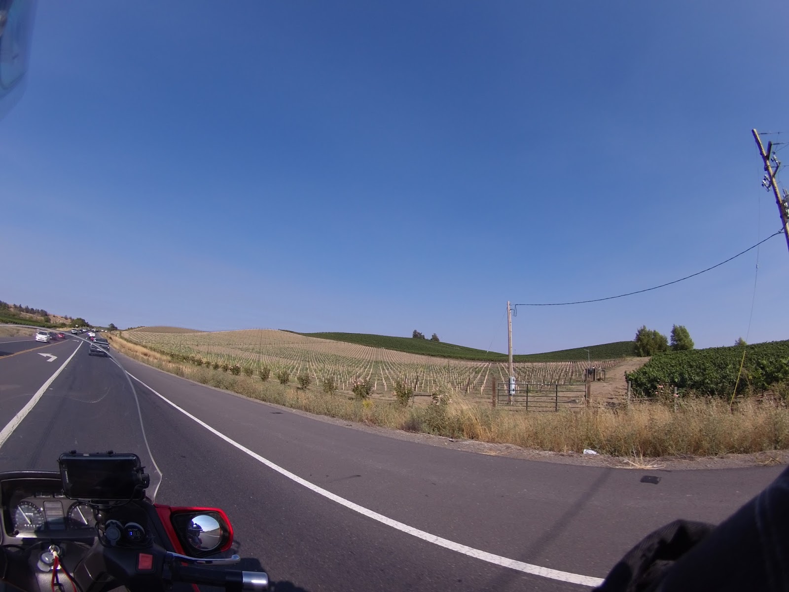
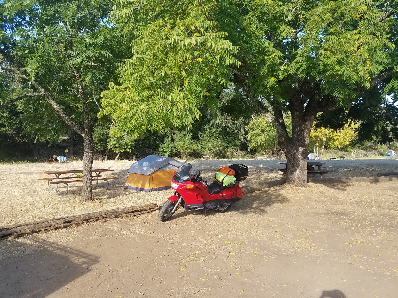
Okay, the days are starting to meld together now. My last post indicated that I had just crossed the Golden Gate Bridge  and camped in Napa, California so that would make today Thursday. After heading inland I found the temperature to be far more stable and comfortable. My goal for today was to reach Oregon, which I did. I camped at the Valley of the Rogue State
Campground.  There, I met a couple from Switzerland that had recently married and decided they would like to tour the world instead of having kids right away or buying a house. They had purchased an old VW bus, converted it into and Vanagon, similar to the Westfalia Van, and had it shipped to Canada. After touring Canada they entered the US and have traveled here for nearly six months. Their next destination is South America. What a daring couple. They were delightful!
Today I headed north on I5 until I reached Toutle River RV Resort  just north of Castle Rock, Washington. It is very nice with laundry facilities, swimming pool, hot tub, etc. etc I have to say however, driving through Portland, Oregon on a Friday afternoon was quite the challenge. It actually made driving thru San Francisco seem like a piece of cake. Bumper to bumper for miles. Lucky I am on a motorcycle, I can maneuver my way through.
Klamath Mountain Range, Oregon (Yes that is snow!)

Pacific Coast Highway / Golden Gate Bridge


Monday morning I headed for the Pacific Coast Highway. My bike is obviously named after the highway and I have  heard great things about the drive and the scenery. My take on that differs somewhat from what others have posted. First I would say if you are planning to travel the PCH, do it from North to South. I went the opposite direction  and feel there was a lot I did not see due to the traffic between me and the coastline. I would also recommend that you give yourself an extra day or two or three in case the fog decides to roll in and obscure your view. Last but not least, dress warm! It can be down right cold with the wind blowing off the ocean, especially if there is fog. I thought the view and weather was nice from Malibu south but north of Malibu, I was cold most of the time. That really surprised me as I always thought of the California coast as being hot.


Laguna Beach, south of Malibu

Malibu was the only place along the beach where I saw houses on the coast side of the highway


Just north of Malibu, notice the fog ahead


Futher north and fog is increasing


Sun is going down and I am still searching for a campground
There are thousands of acres of forest on fire in Big Sur at this time
so camping spaces 
are hard to find.
After searching for
hours for a 
campground that was not full I finally lucked out at one of the state run beach campgrounds. This particular campground was also full but a very nice couple offered to share their campsite with me. It was a beautiful night and I was still in southern California where it was actually warm, so I just set up my Ther-ma-rest cot, laid out my sleeping bag, and fell asleep under the stars listening to the sounds of the ocean. Tuesday morning I tried to plan a little better as far as where I could camp for the night. I must have called ten different campgrounds looking for a place to put my tent and all were full. There was one in Montery, CA that was in a county park. I tried calling several times but could never reach anyone so I decided to chance it. I lucked out! I arrived about 4:30 pm and claimed one of the last open campsites. Not only did I find a campsite, this one actually had hot showers! This morning after having coffee with the campers next to me I set out for the Golden Gate Bridge. Again it was cold along the coast and I decided that once I crossed the bridge, I was going to head inland for warmer weather. Getting to the bridge was quite an experience. I had to drive through San Francisco which is where I ran into the most traffic I have seen since leaving Maine. One thing that cyclist do in California is to drive on the dividing line between cars that are either stopped or going very slowly due to heavy traffic. I really did not think that I would ever do that myself but came to realize that in California, you either participate in lane splitting, so they call it, or your bike overheats and melts right between your legs. So yes, I did my share of lane splitting, but it is not something that I would want to do on a daily basis. I finally made it to the Golden Gate Bridge and was surprised at the number of people that walk across the bridge. The fog was very heavy so pictures were really limited.


Crossing the Golden Gate Bridge - Heavy Fog


 Once over the bridge I stuck to my plan and headed inland to warmer weather. Tonight I am camping at Skyline Wilderness Park in Napa,CA, the land of grapes, grapes and more grapes.


The little white stacks are freshly planted grapes while all the green are mature


Sunday, July 24, 2016

The Grand Canyon


After visiting Bryce Canyon, I traveled on down to the Grand Canyon hoping to overnight in the park. As it turns out the park campgrounds are generally booked year round; however, I was able to camp just 5 miles outside of the park at De Motte National Campground. Saturday morning I went back into the park to get a view from the north rim. I had visited the south rim of the park years ago while on a business trip with the Associated Press. I was surprised at the difference in views from the north rim and the south rim. As I recall, the south rim view was mostly that of a very barren canyon while the north rim view includes a lot of vegetation. Both views are incredible. The photos here are taken from the north rim.

Note the girl on the edge..scary


Leaving the Grand Canyon National Park I headed out for San Ysidro, California. San Ysidro will be the third corner in my four corners tour. Realizing I would not make it all the way to San Ysidro in one day I stopped at the Hualapai Mountain Park, a county park run by Mohave County, Arizona. It was really a nice place to camp. The camp offered cabins, tepees, RV sites and tent sites. The tent sites were scattered up the mountain road so I drove about three quarters of the way up the mountain and found a very suitable site. I even had my on private porta potty. It was a very peaceful night  with a full moon and no insects.
Hualapai Mountain Park - Beautiful view from my tent!
 
This morning I set out again for San Ysidro. I did not plan to travel all the way to San Ysidro in one day but I did.  I stopped at two campgrounds on the way and both were gated with a check in time up to 4:30pm. I found that very odd.  I normally do not travel on the bike at night, much less through the mountains, but sometimes you have to do what you have to do, so that's what I did and eventually arrived in San Ysidro where I decided to crash at the local Motel 6. 


San Ysidro / 3rd corner

Friday, July 22, 2016

Take a deep breath!!


Waking up yesterday morning I felt a little shaken from the loose gravel or chipping incident. In addition to minor bike damage, I also sustained a mild shoulder injury. I call it mild now; however, it did not feel so mild at the time. The shoulder was better but still sore so I chose to spend another day in the Capitol Reef National Park Campgrounds. I'm glad I did. I went into town and took a nice refreshing shower at the local general store public shower and did some laundry.  At the end of the day I returned to the campground and took my favorite picture so far as the sun lit up the canyon wall. It was without a doubt a beautiful site.


As the sun set, the mountain glowed!

Today my shoulder feels better and I am back on the road. After packing the bike I headed out for Bryce Canyon, Utah. Traveling the historic Highway 12 in Utah is quite an adventure in itself. There is one section approximately 5 miles long that is called the Hogs Back. It literally has no shoulders on either side. Nor does it have guardrails.The Hogsback is a portion of Highway 12 that travels over the narrow spine of a mesa with canyons on either side created by Boulder Creek and the other side is Calf Creek.


This is a stock photo of the Hogsback
Photos and video will never do the Hogsback justice, you have to stand there on it and take in its breath taking views to truly appreciate its majesty. 


Continuing beyond the Hogsback I eventually reached Bryce Canyon. The Hoodoos in Bryce Canyon are unlike anything I have seen in any 
of the other canyons. Hoodoos are tall skinny spires of rock that protrude from the bottom of arid basins and "broken" lands.
The difference between Hoodoos and pinnacles or spires is that hoodoos have a variable thickness often described as having a "totem pole-shaped body." A spire, on the other hand, has a smoother profile or uniform thickness that tapers from the ground upward. At Bryce Canyon, hoodoos range in size from that of an average human to heights exceeding a 10-story building.

Wednesday, July 20, 2016

Chipping???


I woke up this morning thinking that I would take the ferry across Lake Powell to the other side of the  Glen Canyon Recreation area. As I approached the ferry landing, I realized it was not going to happen. The road down to the ferry was a very steep grade with loose gravel from top to bottom. Loose gravel and motorcycles generally do not go together very well. So off I went back tracking the road I came in on yesterday. All was fine for about the first 40 miles then suddenly I came upon road construction. I was the only one on the road that I could see; however, the lady flag person told me there would be about a 20 minute wait before I could proceed. I asked what they were doing to the road as I had just traveled the same road the day before and all seemed fine. She told me they were chipping. I did not know what chipping was but soon found out. As the pilot truck guided me down the opposite side of the highway I realized that chipping was the process of applying fresh tar with about one half inch of loose gravel on top. This process really makes a nice road; however, it is not a road you want to drive on until the packers have packed the gravel into the tar. Just as the pilot truck was approaching the end of the construction area he was forced to turn back onto the chipped surface due to a maintenance truck blocking the road. I too had no alternative, it was either follow the pilot truck or go off the road. Well I did both. As I followed the pilot truck onto the freshly chipped surface I realized this was like riding on ice. I could not turn nor could I stop. Off the road I went into the brush and red clay and down. Luckily there was no steep drop off at this point just soft shoulders. Of course I ripped off another mirror along with one of my add on running lights. The mirror did not break but did pull the wiring out of the turn signal plug. It was a two piece plug. One piece which is now buried in the deserts of Utah along with the running light. When the wires pulled out from the turn signal, they shorted together causing my temperature gauge, gas gauge and speedometer to stop working. After getting back on the road I found a pull off and was able to reattach the mirror and fix the wiring for the turn signal so that it would work. The gas gauge etc. was fixed by replacing a blown fuse. I traveled on and finally arrived at my next destination, Capitol Reef National Park Campgrounds located about 10 miles northeast of Torrey, Utah. The campground is located in a peach gorge and is surrounded by shear cliffs. It's very pretty. Once I got settled in it began to rain, but that was fine with me, all I wanted to do was get a good nice nights rest.


My campsite at Capitol Reef Campground - Utah


The following photos were taken as I was leaving the campground


Monday, July 18, 2016

Colorado and Utah


After spending a quite Sunday morning at the Last Resort Campgrounds in southern Colorado, I headed for the Colorado mountains. I recall saying that the Blue Ridge Parkway was short on guardrails. Well let me just say that Colorado must assume if you hit a guardrail going in excess of 20 mph, then you're going thru it anyway. I can tell you, it is a bit scary at an elevation of 10,000 feet, on a motorcycle, to come into a curve with no guardrail. Not that the guardrail would make it any safer, but it would make me feel better.

See what I mean about the guard rails

 The "Million Dollar Highway" between Durango and Ouray is a beautiful ride and also exhausting. At all times you have to watch for signs, oncoming cars and of course you have to check out the scenery. The one thing that really concerned me was a highway sign indicating "freshly oiled roads". I'm on a motorcycle people, freshly oiled roads really concerns me. 


Bear Creek Falls located under the highway.


I did however make it to the top and then back down to Cortez, where I over nighted.
Today I set out for Utah. I recall traveling through Utah once while working for the Associated Press. The landscape was spectacular then and still is today. It is truly a must see state. It reminds me of when I was a young boy playing Cowboys and Indians. Please, no offense intended. I am sure that The Lone Ranger along with Rawhide and every other western program filmed in the 1950's had to of been filmed in Utah. Tonight, I am camping above Powell Lake in Glen Canyon, Utah.  

Campground view #1

Campground view #2

Sunset-view from my campsite

Powell Lake